Day 44 – The Valley Of Death
Today was mainly a driving day, with us heading to our accommodation in Bakersfield, California via Death Valley National Park. The morning began with us checking out of the Venetian, which was definitely a shame given we are going back to hit-or-miss motels for the next few nights.
The drive to Death Valley took us through some of the harshest terrain we have seen, with miles of desert on either side of the road. At one stage the GPS mistakenly took us down an unpaved road for 15 miles (we checked that it led back to a main road before continuing on it!). We didn’t see a single car, house or even an animal for the whole stretch, which had us both very worried in case we broke down – luckily we didn’t! The unpaved stretch also took us across the Nevada/California border so we are now in our 18th and final state of the trip.
Eventually we reached the national park boundary, and we started by driving to Devil’s View, which is an overlook to Death Valley. The road to the viewpoint was a great winding pass, and when we came out at the top the view took us by surprise because of the salt flats below (see photo). We next drove down into the valley, which features the lowest point in the Western Hemisphere at –280ft below sea level. We also learnt a bit about the valley and how the land was formed by the Earth’s crust parting at that point, and the salt being from an ancient evaporated lake (though we predicted that after seeing Salt Lake’s flats!). Another interesting fact is that the valley has the highest average temperature of anywhere in the world, with the ground hot enough to cook an egg on in the summer! Luckily today was mild for the valley at about 85 degrees, which felt hot enough.
The second half of the day was spent covering the remaining 260 miles to Bakersfield (which is a very average town). On the way we made a stop at some of the park’s sand dunes. They were great fun to walk up, though quite a challenge with the sand slipping away under our feet.
The main road out of Death Valley to the west is Route 190, which is another example of remarkable road building, and allowed the region to open up to tourists. It crosses two mountain ranges and goes from around 200 feet below sea level, and up to over 5000 feet. Unfortunately after we crossed the first mountain range we hit a thunder storm and couldn’t really appreciate the amazing scenery (though we did appreciate the dipping road which was like driving up a giant staircase). We even missed the tallest mountain in the contiguous 48 states – Mt. Whitney – due to one of the darkest clouds we have ever seen hanging over it.
Overall the driving today was some of the most unnerving yet, with unpaved roads, steep mountain ascents and descents in the rain, and isolated desert roads which are near-pitch black at night – very exciting!
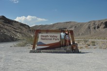
Photo(s) of the day: us at the Death Valley entrance, and a panorama from Dante’s View showing the valley and salt flats.


